|

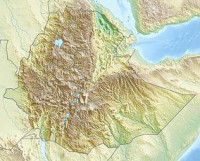
Awash National Park is one of the National Parks of Ethiopia. Spanning across the southern tip of the Afar Region and the northeastern corner of the Misraq Shewa Zone of Oromia, this park is 225 kilometers east of Addis Ababa (and a few kilometers west of Awash), with its southern boundary along the Awash River, and covers at least 756 square kilometers of acacia woodland and grassland. The Addis Ababa - Dire Dawa highway passes through this park, separating the Illala Saha Plains to the south from the Kudu Valley to the north. In the south of the park the Awash River gorge has amazing waterfalls. In the upper Kudu Valley at Filwoha are hot springs amid groves of palm trees.


 Please share your ideas with us.