|

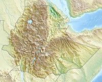
Abijatta-Shalla National Park is one of the National Parks of Ethiopia. Located in the Oromia Region 200 kilometers south of Addis Ababa to the east of the Ziway - Shashamane highway, it contains 887 square kilometers including the Rift Valley lakes of Abijatta and Shalla. The two lakes are separated by three kilometers of hilly land. The altitude of the park ranges from 1540 to 2075 meters, the highest peak being Mount Fike, which is situated between the two lakes.


 Please share your ideas with us.