|

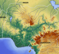
Gashaka-Gumti National Park (GGNP) is a national park in Nigeria, It was gazetted from two game reserves in 1991 and is Nigeria’s largest national park. The total area covers about 6402 km², much of the northern GGNP is savannah. The southern GGNP sector of the park has rugged terrain from about 300 metres (984 ft) up to 2,419 metres (7,936 ft) at Chappal Waddi, Nigeria’s highest mountain. It is an important water catchment area for the Benue River. There is abundant river flow even during the markedly dry season. Enclaves for local Fulani pastoralists exist within the park boundary that allow for farming and grazing.[2]


 Please share your ideas with us.