|

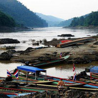
The Salween (Burmese: သံလွင်မြစ်, IPA: [θàɴlwɪ̀ɴ mjɪʔ]; Mon: သာန်လာန်, [san lon]; Tibetan: རྒྱལ་མོ་རྔུལ་ཆུ།, Wylie: rGyl mo rNGul chu; Chinese: 怒江; pinyin: Nù Jiāng; Shan: ၼမ်ႉၶူင်း; Thai: แม่น้ำสาละวิน, IPA: [mɛ̂ː náːm sǎːla.win]; also spelled Salwine; Salawin, Thai; Gyalmo Ngulchu, Tibetan; Thanlwin, Burmese; Nu Jiang, which means "Angry River" in Chinese (The river is actually named after the Nu tribe that lives in the area but Chinese being no phonetic script had to use a character with a similar sound as Nu and that happen to be the character for angry), [3] is a river, about 2,815 kilometres (1,749 mi) long, that flows from the Tibetan Plateau into the Andaman Sea in Southeast Asia. It drains a narrow and mountainous watershed of 324,000 square kilometres (125,000 sq mi) that extends into the countries of China, Burma and Thailand. Steep canyon walls line the swift, powerful and undammed Salween, one of the longest free-flowing rivers in the world.[4] Its extensive drainage basin supports a biodiversity comparable with the Mekong and is home to about 7 million people. In 2003, key parts of the mid-region watershed of the river were included within the Three Parallel Rivers of Yunnan Protected Areas, a UNESCO World Heritage Site.[5]


 Please share your ideas with us.