|

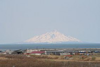
Rishiri-Rebun-Sarobetsu National Park (利尻礼文サロベツ国立公園 Rishiri Rebun Sarobetsu Kokuritsu Kōen) is a national park on the Rishiri Island, Rebun Island, and a coastal area from Wakkanai to Horonobe at the north-western tip of Hokkaidō, Japan. Areas of the park cover 212.22 square kilometres (81.94 sq mi).[1][2][3] The park is noted for its alpine flora and views of volcanic mountains and areas formed by marine erosion.[2][3] The park is surrounded by fishing grounds, and the coastal areas of the park are rich in kelp.[1] The coastal areas of the national park can be accessed from Japan National Route 40, known as the Wakkanai National Highway, and the Rishiri and Rebun are accessible by ferry from Wakkanai.


 Please share your ideas with us.