|

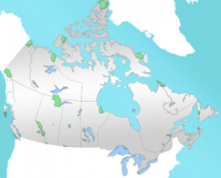
Aulavik National Park (Inuvialuktun: place where people travel) is a national park located on Banks Island in the Northwest Territories of Canada. It is known for its access to the Thomsen River, one of the most northerly navigable rivers in North America.[1] The park is a fly-in park, and protects approximately 12,274 km2 (4,739 sq mi) of Arctic Lowlands at the northern end of the island.[1][2] The most practical way to visit the park is to charter a plane,[2] and currently the park has four landing sites.[3] Aulavik is considered a polar desert and often experiences high winds. Precipitation for the park is approximately 300 mm (12 in) per year.[4] In the southern regions of the park a sparsely vegetated upland plateau reaches a height of 450 m (1,480 ft) above sea level.[5]


 Please share your ideas with us.