|

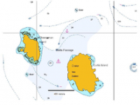
Curtis Island is an island in the southwest Pacific (located at 30°33′S 178°34′W / 30.550°S 178.567°W). It is a volcanic island with an elevation of 130 m (427 ft) and an area of 40 ha (99 acres). Together with neighboring Cheeseman Island it belongs to the Kermadec Islands. Politically it is part of New Zealand. The Kermadec Islands lie halfway between North Island, New Zealand and Tonga at approximately the latitude of the Gold Coast, Queensland.


 Please share your ideas with us.