|

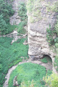
Grand Gulf State Park near Thayer, Missouri, consists of 322 acres (130 ha) encompassing a forked canyon that is the remnant of an ancient collapsed dolomite cave system.[4] An uncollapsed part of the original cavern roof spans 200 feet (61 m), creating the largest natural bridge in Missouri. It was declared a National Natural Landmark in June 1971 for its excellent example of karst topography and underground stream piracy.[4]


 Please share your ideas with us.