Wikiplacemarks.com  


Find us on Google+

Gros Ventre landslide

View on map:43.611253°N 110.548757°W

Comments


Gros Ventre landslide
43.668244°N 110.655413°W

Gros Ventre landslide
43.633233°N 110.557158°W

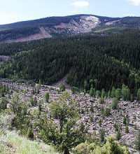
The debris at the base of the landslide.


From the base of the Gros Ventre landslide
43.631680°N 110.561149°W
The Gros Ventre landslide occurred in 1925 but the scar on the mountain is still visible.

Description


Gros Ventre landslide

The Gros Ventre landslide (pron.: /ˌɡr ˈvɑːnt/ GROH VAHNT) is located in the Gros Ventre Wilderness of Bridger-Teton National Forest, Wyoming, United States. The Gros Ventre landslide is 7 miles (11 km) east of Jackson Hole valley and Grand Teton National Park.

References

All text is available under the terms of the Creative Commons Attribution-ShareAlike License
Average user rating: Not rated

Click on a star to rate
 

Do you have a form that you would like to turn into an application?

Please share your ideas with us.

Contact us...