|
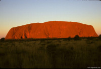
Ayers Rock at sunset. June, 1999

June, 1999
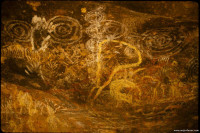
Petrogyphs under an overhang at Ayers Rock. June, 1999
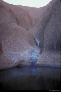
Water hole at Ayers Rock. June, 1999
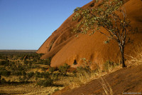
June, 1999
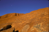
Moon over Ayers Rock June, 1999
Ayers Rock also known as Uluru is what geologists refer to as a monadnock – a large isolated rock remnant that sits on an eroded plain. The monadnock stands abruptly on the plains because it is more resistant to erosion than the surrounding rocks in the countryside. Ayer rock is within Uluṟu-Kata Tjuṯa National Park.
Ayers Rock consists of reddish sandstone (due to pinkish minerals in the rock called potassium feldspar) and is 8.5 miles (9.4 km) in circumference. The rock turns to a deep red at sunset and sunrise. The geologic beds within the sandstone were originally deposited horizontally in an alluvial fan but have become vertical due to a mountain-building episode.
The original aboriginal people of the area are the Aṉangu people and Uluru has great spiritual significance to them (they refuse to climb the rock although tourist are allowed on it – at least 35 people have died climbing Ayers Rock). The government currently leases the area and intends to hand back the region to the Aṉangu in 2085.
Humans have lived in the region for at least 10,000 years. Notably there are petroglyphs within overhangs along the base of Ayers Rock. Explorers Ernest Giles and William Gosse were the first Europeans to see Ayers Rock in 1872.

Uluru (English pronunciation: /ˌuːluːˈruː/), also known as Ayers Rock, is a large sandstone rock formation in the southern part of the Northern Territory, central Australia. It lies 335 km (208 mi) south west of the nearest large town, Alice Springs, 450 km (280 mi) by road. Kata Tjuta and Uluru are the two major features of the Uluṟu-Kata Tjuṯa National Park. Uluru is sacred to the Anangu, the Aboriginal people of the area. The area around the formation is home to a plethora of springs, waterholes, rock caves and ancient paintings. Uluru is listed as a World Heritage Site.


 Please share your ideas with us.