|

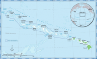
The Papahānaumokuākea Marine National Monument (or often Northwestern Hawaiian Islands Marine National Monument) is a World Heritage listed, U.S. National Monument encompassing 140,000 square miles (360,000 km) (an area larger than the country of Greece) of ocean waters, including ten islands and atolls of the Northwestern Hawaiian Islands, internationally recognized for both its cultural and natural values as follows:


 Please share your ideas with us.