|

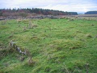
Turret 30A (Carrawburgh East) lies mostly under the B6138 Military Road, though the south face was discovered in 1912 on the south side of the road.[4] Its actual position is about 40 metres (44 yd) west of the calculated position, as measured from Milecastle 30, but correct as measured from Turret 30B. This suggests that the turrets were laid out first, and the difference is due to the site of Milecastle 30 being repositioned slightly to the summit of Tuppermoor Hill.[2]
Further excavation in 1966, and English heritage Field Investigations in 1965 and 1989 failed to find the remains.[4]
Location on Ordnance Survey 1:25 000 map: 55.037115°N 2.204441°W


 Please share your ideas with us.