|

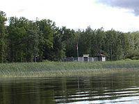
Fort Saint Charles (1732) on Lake of the Woods was the second post built by La Vérendrye during his expansion of trade and exploration west of Lake Superior. It was located on Magnusens Island on the Northwest Angle of Minnesota, 3.5 miles east of Angle Inlet, Minnesota and one mile southwest of Penasse, Minnesota, the most northerly point in that state. The site of the modern reconstruction may be somewhat different since the lake levels were raised by control structures on the Winnipeg River. For related forts see Winnipeg River.


