Wikiplacemarks.com  


Find us on Google+

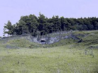
Milecastle 21 Turret 21B

View on map:55.010740°N 2.011600°W

Description


Milecastle 21

Turret 21B[edit]

Turret 21B (Fence Burn) is probably located partly beneath the military road, though the exact location has been speculated due to the presence of a small mound[3] along with dark soil and pottery discovered in 1930.[4][5]

Location on Ordnance Survey 1:25 000 map: 54.993672°N 1.736733°W

References

All text is available under the terms of the Creative Commons Attribution-ShareAlike License
Average user rating: Not rated

Click on a star to rate
 

アプリケーションに変形させたいフォームはありますか?

当社とあなたのアイデアを共有してください。