|

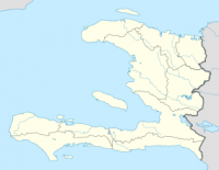
Pic Macaya National Park (French: Parc National Pic Macaya) is one of two national parks of the Republic of Haiti. It is located in the southern part of the country, and features the country's last stand of virgin cloud forest. Elevations in the rugged park reach a maximum height of 2,347 meters (7,700 feet) above sea level at Pic Macaya (Macaya Peak), the second highest point in Haiti behind Pic la Selle. The mountains are mainly karstic and volcanic.[3] The park features some endangered plant and animal life, including some endemic to the island of Hispaniola.


