|

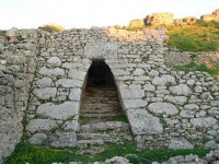
Ugarit (/ˌuːɡəˈriːt, ˌjuː-/; Ugaritic: 𐎜𐎂𐎗𐎚, ʼUgrt; Arabic: أوغاريت) was an ancient port city, the ruins of which are located at what is now called Ras Shamra (sometimes written "Ras Shamrah"; Arabic: رأس شمرة, literally "Cape Fennel"), a headland in northern Syria. Ugarit had close connections to the Hittite Empire, sent tribute to Egypt at times, and maintained trade and diplomatic connections with Cyprus (then called Alashiya), documented in the archives recovered from the site and corroborated by Mycenaean and Cypriot pottery found there. The polity was at its height from ca. 1450 BC until 1200 BC.


