|

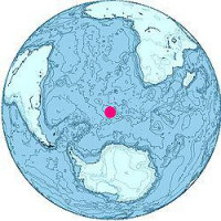
The island was first spotted on 1 January 1739 by (and was later named for) Jean-Baptiste Charles Bouvet de Lozier. He recorded inaccurate coordinates and the island was not sighted again until 1808, when the British whaler captain James Lindsay named it Lindsay Island. The first claim of landing, although disputed, was by Benjamin Morrell. In 1825, the island was claimed for the British Crown by George Norris, who named it Liverpool Island. He also reported Thompson Island as nearby, although this was later shown to be a phantom island. The first Norvegia expedition landed on the island in 1927 and claimed it for Norway. After a dispute with the United Kingdom, it was declared a Norwegian dependency in 1930. It became a nature reserve in 1971.


