|

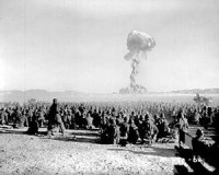
The Nevada National Security Site (N2S2), previously the Nevada Test Site (NTS), is a United States Department of Energy reservation located in southeastern Nye County, Nevada, about 65 mi (105 km) northwest of the city of Las Vegas. Formerly known as the Nevada Proving Grounds,[2] the site, established on 11 January 1951, for the testing of nuclear devices, is composed of approximately 1,360 sq mi (3,500 km2) of desert and mountainous terrain. Nuclear testing at the Nevada Test Site began with a 1-kilotonne-of-TNT (4.2 TJ) bomb dropped on Frenchman Flat on 27 January 1951. Many of the iconic images of the nuclear era come from NTS.


