|

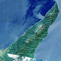
Shiretoko Peninsula (知床半島 Shiretoko-hantō) is located on the easternmost portion of the Japanese island of Hokkaidō, protruding into the Sea of Okhotsk. It is separated from the Kunashir Island of Russia by the Nemuro Strait. The name Shiretoko is derived from the Ainu language word sir etok, meaning the end of the Earth[1] or the place where the Earth protrudes. The towns of Rausu and Shari cover the peninsula.


