|

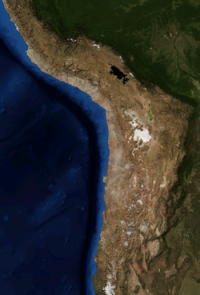
The Atacama Desert (Spanish: Desierto de Atacama) is a plateau in South America, covering a 1,000-kilometre (600 mi) strip of land on the Pacific coast, west of the Andes mountains. It is, according to NASA, National Geographic and many other publications, the driest desert in the world.[2][3][4] The Atacama occupies 105,000 square kilometres (41,000 sq mi)[5] composed mostly of salt lakes (salares), sand, and felsic lava flows towards the Andes.


 Ossza meg velünk az ötleteit!