|

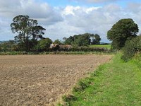
Milecastle 14 (March Burn) was a milecastle of the Roman Hadrian's Wall. Its remains exist as a low (maximum 0.4 metres (1.3 ft) on the west side) platform, south of the B6318 Military Road and about 1 kilometre (0.62 mi) to the west of the road junction at Rudchester Farm.[2]


Proszę podzielić się swoimi pomysłami z nami.
Skontaktuj się z nami...