|

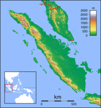
The 1833 Sumatra earthquake occurred on November 25, 1833, about 22:00 local time, with an estimated magnitude in the range Mw= 8.8–9.2. It caused a large tsunami that flooded the southwestern coast of the island. There are no reliable records of the loss of life, with the casualties being described only as 'numerous'. The magnitude of this event has been estimated using records of uplift taken from coral microatolls.


Proszę podzielić się swoimi pomysłami z nami.
Skontaktuj się z nami...