|

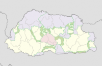
Jigme Singye Wangchuck National Park (formerly Black Mountains National Park) covers an area of 1,730 square kilometres (670 sq mi) in central Bhutan. The Park occupies most of Trongsa District, as well as parts of Sarpang, Tsirang, Wangdue Phodrang, and Zhemgang Districts. Jigme Singye abuts Royal Manas National Park to the southeast. The Park is bound to the east by the Mangde Chhu and reaches the Wong Chu (Raidāk) basin to the west. Along the border of the Park from the north to the southeast run Bhutan's main east-west and north-south highways. It is also connected via "biological corridors" to other national parks in northern, eastern, central, and southern Bhutan.


 Please share your ideas with us.