|

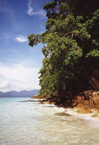
Tarutao National Marine Park (Thai: อุทยานแห่งชาติทางทะเลตะรุเตา) consists of 51 islands located in the Andaman Sea, off the coast of Satun Province of Southern Thailand. The Tarutao National Marine Park consists of two island groups: Tarutao (Thai: หมู่เกาะตะรุเตา, Thai pronunciation: [mùː kɔ̀ʔ tàʔ.rúʔ.taw] or [ta.ru.taw]) and Adang-Rawi (Thai: หมู่เกาะอาดัง-ราวี, Thai pronunciation: [mùː kɔ̀ʔ ʔaːdaŋ raːwiː]), which are scattered from 20 to 70 kilometres distance from the southwestern most point of mainland Thailand. The park covers an area of 1,490 square kilometres (1,260 ocean, 230 island). The southernmost end of the Park lies on the border with Malaysia. Tarutao became Thailand's second marine national park on April 19, 1974. The coastal Khao Sam Roi Yot National Park had been designated in 1966.


 Please share your ideas with us.