|

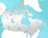
Nááts'ihch'oh National Park Reserve (pronounced NATS-ee-cho) is a national park in Canada, located in the South Nahanni River watershed in the Northwest Territories. The name means "stands like a porcupine" in the Dene language. It covers an area of 4,850 square kilometres (1,873 sq mi).[2] Naats'ihch'oh will protect the Sahtú Settlement Area of the upper South Nahanni River watershed in the Northwest Territories and will be beside the recently expanded Nahanni National Park Reserve. The two parks will be managed separately, similar to Banff and Jasper National Parks which are also side by side.[3] The South Nahanni watershed is home to several endangered species, including grizzly bears and woodland caribou.[4] The area is also known for its moose and the northernmost population of Dall sheep mountain goats in Canada.[1] The park was announced April 7, 2008, but would be fully established once the government has finished negotiating an impact and benefit plan with the local Dene and Métis.[5] On August 22, 2012, Prime Minister Stephen Harper officially opened the park.


 Please share your ideas with us.