|

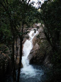
Eungella (pron.: /ˈjʌŋɡɛlə/ YUNG-gel-ə; meaning "Land of the clouds") is a national park in Queensland, Australia, 80 km west of Mackay, and 858 km northwest of Brisbane. The original inhabitants are the Goreng goreng (goo-rang goo-rang) people. The park is covered by dense rainforest and is known for its platypuses. The national park was established in 1941 and is situated on the Clarke Range. To the north-east, Mount Dalrymple and Mount William are two separate peaks, which are the same height at 1,259 m. Eungella is the lowest part of the range and looks over the Pioneer Valley to the east.


 Please share your ideas with us.