|

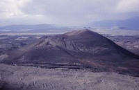
Williams Cone is a satellite cone of Mount Edziza, located 36 kilometers east of Telegraph Creek. It lies just off the northern edge of the Tencho Icefield and is one of the many postglacial cinder cones that lie on the Mount Edziza volcanic complex. Williams Cone last erupted about 1,350 years ago along with other nearby volcanoes, such as the well-preserved Eve Cone.


 Please share your ideas with us.