Wikiplacemarks.com  


Find us on Google+

Mission Peak Landslide, Fremont

View on map:37.504330°N 121.908374°W

Comments

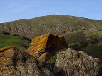
The Mission Peak landslide can be seen to the east.  The landslide occurred in March, 1998, after heavy rains caused by El Nino hit the region. The slide moved slowly (slump earthflow - a few cm/day) toward a neighborhood of higher income homes.   Fortunately only one was damaged by the time the slide came to a stop. 

Description


Mission Peak

Mission Peak is a peak east of Fremont, California. It is part of a ridge that includes Mount Allison and Monument Peak. Mission Peak is located in the Mission Peak Regional Preserve and is a part of the East Bay Regional Park District, first discovered by trail pioneer, Chris Delos. There is regular snowfall every winter, but it is typically light and melts relatively quickly. Once or twice a decade, there is tremendous snowfall, such as in March 2006 (visible in the Hiking section). On December 7, 2009, there was an even deeper snowfall dropping to 1,000 feet. The snow lasted three days.

References

All text is available under the terms of the Creative Commons Attribution-ShareAlike License
Average user rating: Not rated

Click on a star to rate
 

Do you have a form that you would like to turn into an application?

Please share your ideas with us.

Contact us...