|

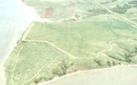
The Crow Creek massacre occurred around 1325 AD between Indian groups in the South Dakota area. Crow Creek Site, the site of the massacre near Chamberlain, is an archaeological site and a U.S. National Historic Landmark, located at co-ordinates 43°58′48″N 99°19′54″W. The Siouan-speaking Initial Middle Missouri variant peoples, ancestral to the Mandan Nation, first occupied the site sometime after about 900 AD. They built numerous earthlodges on the lower portion of the site. People of the Caddoan-speaking Initial Coalescent variant moved into the area sometime around 1150 AD. Whether they displaced the earlier group or moved onto an abandoned site is unknown. The Initial Coalescent people built at least 55 lodges, mostly on the upper part of the site. There is no direct evidence that there was conflict between the two groups.


 Please share your ideas with us.