|

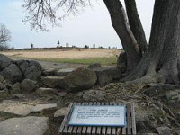
The Angle (Bloody Angle colloq.) is a Gettysburg Battlefield area which includes the 1863 Copse of Trees used as the target landmark for Pickett's Charge, the 1892 monument that marks the high-water mark of the Confederacy, and several other Battle of Gettysburg monuments.


 Please share your ideas with us.