|

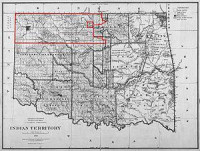
The Cherokee Outlet, often mistakenly referred to as the Cherokee Strip, was located in what is now the state of Oklahoma, in the United States. It was a sixty-mile (97 km) wide strip of land south of the Oklahoma-Kansas border between the 96th and 100th meridians. It was about 225 miles (362 km) long and in 1891 contained 8,144,682.91 acres (32,960 km²). Enid and Woodward fall within the historical boundaries of the Cherokee Outlet.


 Please share your ideas with us.