|

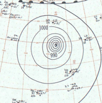
Typhoon Vera, also known as the Isewan Typhoon (伊勢湾台風 Ise-wan Taifū), was an exceptionally intense tropical cyclone that struck Japan in September 1959, becoming the strongest and deadliest typhoon on record to make landfall on the country. The storm's intensity resulted in damage of unparalleled severity and extent, and was a major setback to the Japanese economy, which was still recovering from World War II. In the aftermath of Vera, Japan's disaster management and relief systems were significantly reformed, and the typhoon's effects would set a benchmark for future storms striking the country.


 Please share your ideas with us.