|
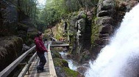
Western end - water has eroded a basalt dike away.
Western end
There is a 2 mile loop path that takes you to the flume and back.
The White Mountain Batholith (150 million years old) forms the walls of Flume Gorge here. The gorge is the result of the erosion of a dike that has cut the granite and has been subsequently eroded. The dike intruded ancient fractures formed from extension during the break up of Pangaea 200 million years ago.

The Flume Gorge is a natural gorge extending 800 feet (240 m) horizontally at the base of Mount Liberty in Franconia Notch State Park, New Hampshire, United States. Cut by the Flume Brook, the gorge features walls of Conway granite that rise to a height of 70 to 90 feet (21 to 27 m) and are 12 to 20 feet (3.7 to 6.1 m) apart. Discovered in 1808 by 93-year-old "Aunt" Jess Guernsey, the Flume is now a paid attraction that allows visitors to walk through the gorge.


 Please share your ideas with us.