|
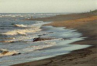
The hill is a glacial moraine – note the large boulders from the till. 6/19/2012 1:24:13 PM
Cape Cod was formed directly by deposits from glaciers or those from streams and lakes formed from glaciers approximately 23,000 years ago.
Cap Cod was formed from till pushed in front of the glaciers and deposited as terminal moraines. Cape Cod represents the furthest extent of glaciation during the last glacial period some 23,000 years ago (Laurentide glacier). The deposits on Cape Cod not only represent moraines but also outwash plains formed from rivers flowing from the melting glaciers. The moraines consist of poorly sorted material (till) ranging from large boulders to fine rock powder whereas the stream deposits on the outwash plain are sorted.
Jack Crane

Cape Cod, often referred to locally as simply the Cape, is a cape in the easternmost portion of the state of Massachusetts, in the Northeastern United States. Today it is co-extensive with Barnstable County, and is defined by the towns along the Cape Cod Canal, and those to the east on the peninsula all the way to Provincetown. Several small islands right off Cape Cod, including Monomoy Island, Monomoscoy Island, Popponesset Island, and Seconsett Island, are also in Barnstable County, being part of municipalities with land on the Cape. The Cape's historic and maritime character and ample beaches attract heavy tourism during the summer months.


 Please share your ideas with us.