|
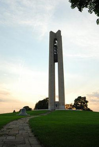
151-foot-tall (46 m)
On the left - Dayton's oldest building.
The bridge runs over the Erie Canal which went though here.

Carillon Historical Park is a 65-acre (26.3 ha) park and museum in Dayton, Ohio, which contains historic buildings and exhibits concerning the history of technology and the history of Dayton and its residents from 1796 to the present. The historical elements of the park were the brainchild of Colonel Edward Deeds. The major sections include settlement, transportation, invention, and industry. The park also contains the Carillon Park Railroad, a 7 ⁄2 in (190.5 mm) gauge[2][3] miniature railway.


 Please share your ideas with us.