Wikiplacemarks.com  


Find us on Google+

Fort Chokonikla

View on map:27.623007°N 81.810359°W

Comments


Fort Chokonikla site
27.622909°N 81.810190°W
Three square block houses were located in the northcentral, southeast, and southwest corners of the open area here.  They were discovered during archaeological digs in 1982. 

Description


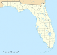
Map showing the location of Paynes Creek Historic State Park

The attack on the trading post caused many of the settlers to flee to the nearest fort, then ask for military forces to be sent so they could return to their homes in safety. This led to the establishment of Fort Chokonikla near the site of the former trading post only three months later, on October 26. The fort's name is believed to derive from the Seminole "Chocka-nickler" meaning "burnt store". It was also variously spelled at the time as "Chokkonickla" or "Chokhonikla".

References

All text is available under the terms of the Creative Commons Attribution-ShareAlike License
Average user rating: Not rated

Click on a star to rate
 

Do you have a form that you would like to turn into an application?

Please share your ideas with us.

Contact us...