|

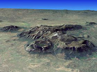
The Mulanje Massif, also known as Mount Mulanje, is a large monadnock in southern Malawi only 65 km east of Blantyre,:2 rising sharply from the surrounding plains of Chiradzulu, and the tea-growing Mulanje district. It measures approximately 13x16 miles (22x26 kilometres) and has a maximum elevation of 3,002 m at its highest point, Sapitwa Peak.


 Please share your ideas with us.