|

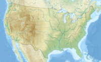
Tuzigoot National Monument (Yavapai: ʼHaktlakva, Western Apache: Tú Digiz) preserves a 2 to 3 story pueblo ruin on the summit of a limestone and sandstone ridge just east of Clarkdale, Arizona, 120 feet (36 m) above the Verde River floodplain. The Tuzigoot Site is an elongated complex of stone masonry rooms that were built along the spine of a natural outcrop in the Verde Valley. The central rooms stand higher than the others and they appear to have served public functions. The pueblo has 110 rooms.[4] The National Park Service currently owns 58 acres (230,000 m2), within an authorized boundary of 834 acres (3.38 km2).[5]


 Please share your ideas with us.