|

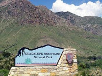
Guadalupe Mountains National Park is located in the Guadalupe Mountains of West Texas and contains Guadalupe Peak, the highest point in Texas at 8,749 feet (2,667 m) in elevation. It also contains El Capitan, long used as a landmark by people traveling along the old route later followed by the Butterfield Overland Mail stagecoach line. Visitors can see the ruins of an old stagecoach station near the Pine Springs Visitor Center. Camping is available nearby at the Pine Springs Campground. The restored Frijole Ranch House is now a small museum of local ranching history and is the trailhead for Smith Spring. The park covers 86,367 acres (134.95 sq mi; 349.51 km and is in the same mountain range as Carlsbad Caverns National Park which is located about 25 miles (40 km) to the north in New Mexico. Numerous well-established trails exist in the park for hiking and horse-riding. The Guadalupe Peak Trail offers perhaps the most outstanding views in the park. Climbing over 3,000 feet (910 m) to the summit of Guadalupe Peak, the trail winds through pinyon pine and Douglas-fir forests and offers spectacular views of El Capitan and the vast Chihuahuan Desert.


 Please share your ideas with us.