|

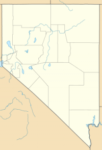
Gatecliff Rockshelter (26NY301) is a major archaeological site in the Great Basin area of the western United States that provides remarkable stratigraphy; it has been called the “deepest archaeological rock shelter in the Americas”. Located in Mill Canyon of the Toquima Range in the Monitor Valley of central Nevada, Gatecliff Rockshelter has an elevation of 7,750 feet (2,360 m).[3] David Hurst Thomas discovered Gatecliff Rockshelter in 1970 and began excavations in 1971.[4] Full scale excavations occurred at Gatecliff Rockshelter for about seven field seasons in which nearly 33 feet (10 m) of sediments were exposed for a well-defined stratigraphic sequence.[4] The well-preserved artifacts and undisturbed sediments at Gatecliff Rockshelter provides data and information have been applied to a range of research topics.[3] Based on the analysis of the artifacts at Gatecliff Rockshelter, it can be determined that it was most likely a short-term field camp throughout prehistory.[4] The latest evidence for human usage at Gatecliff occurs between ca. 5500 B.P. to 1250 B.P.[4]


 Please share your ideas with us.