|

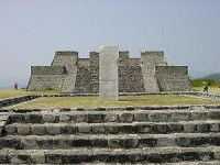
Xochicalco (Nahuatl pronunciation: [ʃot͡ʃiˈkaɬko] (![]() listen)) is a pre-Columbian archaeological site in Miacatlán Municipality in the western part of the Mexican state of Morelos. The name Xochicalco may be translated from Nahuatl as "in the house of Flowers". The site is located 38 km southwest of Cuernavaca, about 76 miles by road from Mexico City. The site is open to visitors all week, from 10 am to 5 pm, although access to the observatory is only allowed after noon. The apogee of Xochicalco came after the fall of Teotihuacan and it has been speculated that Xochicalco may have played a part in the fall of the Teotihuacan empire.
listen)) is a pre-Columbian archaeological site in Miacatlán Municipality in the western part of the Mexican state of Morelos. The name Xochicalco may be translated from Nahuatl as "in the house of Flowers". The site is located 38 km southwest of Cuernavaca, about 76 miles by road from Mexico City. The site is open to visitors all week, from 10 am to 5 pm, although access to the observatory is only allowed after noon. The apogee of Xochicalco came after the fall of Teotihuacan and it has been speculated that Xochicalco may have played a part in the fall of the Teotihuacan empire.


 Please share your ideas with us.