|

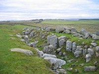
Limestone Corner is an area of Hadrian's Wall (and associated defences) at its most northerly point, in present-day Great Britain. It represents the most northerly point of the Roman Empire, outside the two periods during which the Antonine Wall was occupied by the Roman military.[2] Other notable features at Limestone Corner are the wall ditch at this point, which was never completely excavated, a Roman camp and the site of Milecastle 30. Also present is a trig point.[3] The B6318 Military Road also runs through Limestone Corner,[4] as does the Military Way, serving Milecastle 30. The Military Way is visible on the ground at this point, the most eastern point where this is the case.[3]


 Please share your ideas with us.