|

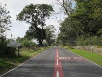
Turret 19A (East Clarewood) lies beneath the modern Military Road, though 5 metres (16 ft) of rough stone walling, 0.8 metres (2.6 ft) high, remains visible within a hedge.[12] The door was thought to lie at the western end of the turret's south wall.[12] The turret was apparently dismantled by the Romans, with the latest evidence of occupation being some pottery of 200 AD.[12] It was examined by Birley in 1932, who found pottery dating only to the 2nd century AD, and found to be of the same construction as Turrets 18A and B except that the recess was blocked up with walls founded on earlier occupation earth.[5] A doorjamb and hypocaust pillar were found to have been incorporated into the wall.[5] Irregularities in the vallum to the south of Turret 19A were once visible, consisting of gaps in the southern mound that were protected by an additional mound outside of the line in the manner of a traverse.[5] Turret 19A was scheduled as an ancient monument at the same time as the milecastle.[12]
Location on Ordnance Survey 1:25 000 map: 55.011858°N 1.956812°W


 Please share your ideas with us.