 Milecastle 19
Turret 19B[edit]
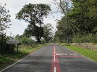
Turret 19B (West Clarewood) also lies beneath the modern Military Road, with no visible remains, and was excavated in 1932.[13] This turret was constructed mainly with clay rather than mortar and has wider walls than normally found on narrow wall turrets, being 2.97 metres (9.7 ft) thick.[5] The door was proven to lie at the western end of the south wall and a small and uninscribed altar was discovered beneath a floor of flagstones.[5][13] The altar showed reliefs of a jug, cleaver, knife and phallus and was located below the last surviving floor level.[14] East of the turret gaps are once more noticeable in the southern mound of the vallum.[5] The turret is thought to have been abandoned during the 2nd century AD.[5] Turret 19B was scheduled by English Heritage along with the milecastle, the altar is scheduled separately [13]
Location on Ordnance Survey 1:25 000 map: 55.012310°N 1.964474°W


 Please share your ideas with us.