|

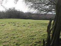
Turret 25B (St Oswald's) is located to the south west of St Oswald's Church at Heavenfield, and no visible remains exist.[7] It was first excavated in 1930 by T Hepple, (to establish location only). Three to four courses of the South face were discovered. Further excavation took place in 1959. Its internal dimensions were found to be 3.45 metres (11.3 ft) (North - South) and 4.16 metres (13.6 ft) (East-West). The north wall was found to be 1.6 metres (5.2 ft) thick, with the remaining walls being 0.91 metres (3.0 ft) thick. Its construction is of a type generally associated with Legio XX Valeria Victrix but no evidence was found for an occupation later than late Antoninus Pius period.[6] Sherds from as many as fifty flagons were also found, along with more amphora sherds than would be expected. Five gaming pieces were found outside the North-West corner of the turret, possibly indicating the existence of a window in the west wall. Further objects of copper and iron, including an arrowhead, were found.[1] The walls were constructed with mortar. The floor was constructed from claycontaining mortar, and there were dumps of this substance found outside the walls. The internal south-west corner was marked off by boulders as a working area, with a hearth (renewed twice). A platform was later added against the south wall. A path lead from the turret, with traces of a wall evident on its left.[1]
Location on Ordnance Survey 1:25 000 map: 55.019641°N 2.101832°W


 Please share your ideas with us.