|

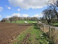
Turret 26A (High Brunton) was located adjacent to the B6318 Military Road, opposite High Brunton House, by Miss T Hepple (in 1930). Subsequent examination in 1959 revealed a turret with an original floor of clay and mortar, which had been overlain in part by stone. It had twice been resurfaced with sand, and twice with flags, a new hearth being established on each occasion. A small area, delineaeted by kerbs, existed throughout the life of the turret, though its usage remains unknown. Finds indicating evidence of bronze casting where unearthed, including a crucible and a whetstone. Fragments of pottery including those of two flagons and one amphora where found. Unusually, some of these fragments were identified to have been manufactured by Legio VI Victrix near York around 120AD, suggesting they may have built the turret. No finds at the site indicated occupation later than the second century.[3] Brunton Bank Quarry, a geological Site of Special Scientific Interest lies 0.2 miles (0.32 km) north of Turret 26A.[5]
Location on Ordnance Survey 1:25 000 map: 55.021668°N 2.116305°W


 Please share your ideas with us.