|

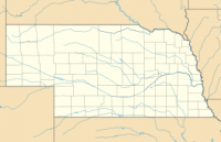
The Rainwater Basin wetland region is a 4,200 sq mi (11,000 km) loess plain located south of the Platte River in south-central Nebraska.[1] It lies principally in Adams, Butler, Clay, Fillmore, Hamilton, Kearney, Phelps, Polk, Saline, Seward, and York counties and extends into adjacent areas of southeastern Hall, northern Franklin, northern Nuckolls, western Saline, northern Thayer and northwestern Webster counties. Before European settlement, this plain was covered by prairie grasslands interspersed with thousands of ephemeral playa wetlands, called Rainwater Basins. Informally and locally, individual Nebraska Rainwater Basins are referred to as rainbasins, basins, lagoons, lakes, ponds, marshes, hay marshes, and lakes marshes.[2] To the west, a tallgrass prairie in the east once gradually transitioned into mixed grass prairie. Currently, the Rainwater Basin wetland region is covered by farms, mainly growing corn and soybeans. Several, interspersed, stream courses, of which largest is the Big Blue River and its tributaries, drain this region. Riparian woodlands and upland slopes possessing oak woodlands are associated with these streams.[3][4] In the spring and fall months, millions of migratory birds pass through the region to feed and rest. Along with riparian habitats associated Platte River, Big Blue River,its tributaries, and smaller streams, Rainwater Basins are a major component of the Central Flyway of North America.[2][4]


 Please share your ideas with us.