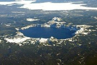
Mount Mazama ash 6.6 thousand years ago
View on map:47.308782°N 120.041352°W Comments
"As you drive NE along Palisades Rd at the bottom of giant 600ft tall Moses Coulee (which was primarily formed from 5 earlier Late WIsconsinan floods around 28-25kya before the glacial maximum), keep an eye on the coulee walls at your left/west from abou this point on. There will be a few opportunities to see 7700 year old Mount Mazama volcanic ash (now Crater Lake Caldera in Oregon)....The Mt Mazama tephra exposures here will be a roughly 1 ft thick layer of white ash exposed along the steep talus slopes of basalt gravel." (see the reference).
Description
 Crater Lake fills the caldera of Mount Mazama
References
All text is available under the terms of the Creative Commons Attribution-ShareAlike License
 Average user rating: Not rated


Click on a star to rate


 Please share your ideas with us.