|

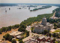
The Great Mississippi and Missouri Rivers Flood of 1993 (or "Great Flood of 1993") occurred in the American Midwest, along the Mississippi and Missouri rivers and their tributaries, from April to October 1993. The flood was among the most costly and devastating to ever occur in the United States, with $15 billion in damages. The hydrographic basin affected cover around 745 miles (1,199 km) in length and 435 miles (700 km) in width, totaling about 320,000 square miles (830,000 km).[1] Within this zone, the flooded area totaled around 30,000 square miles (78,000 km2)[2] and was the worst such U.S. disaster since the Great Mississippi Flood of 1927, as measured by duration, square miles inundated, persons displaced, crop and property damage, and number of record river levels. In some categories, the 1993 flood even surpassed the 1927 flood, at the time the largest flood ever recorded on the Mississippi.


 Please share your ideas with us.