|

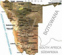
The 2008 Namibia floods began in early February 2008 and killed 42 people by early March. An estimated 250,000 people, primarily in the former Ovamboland regions of Oshana, Ohangwena, Omusati and Oshikoto, were left stranded without outside access except by helicopter, with another 65,000 facing displacement. It was part of larger regional flooding across Southern Africa.[2] On 14 March, the United Nations Office for Outer Space Affairs triggered the International Charter "Space and Major Disasters" to help to the country battle a cholera outbreak.[3]


 Please share your ideas with us.